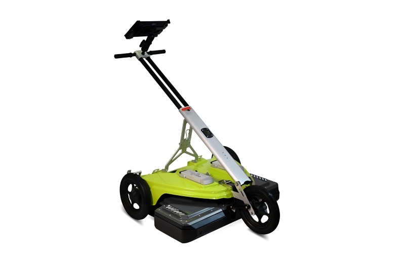
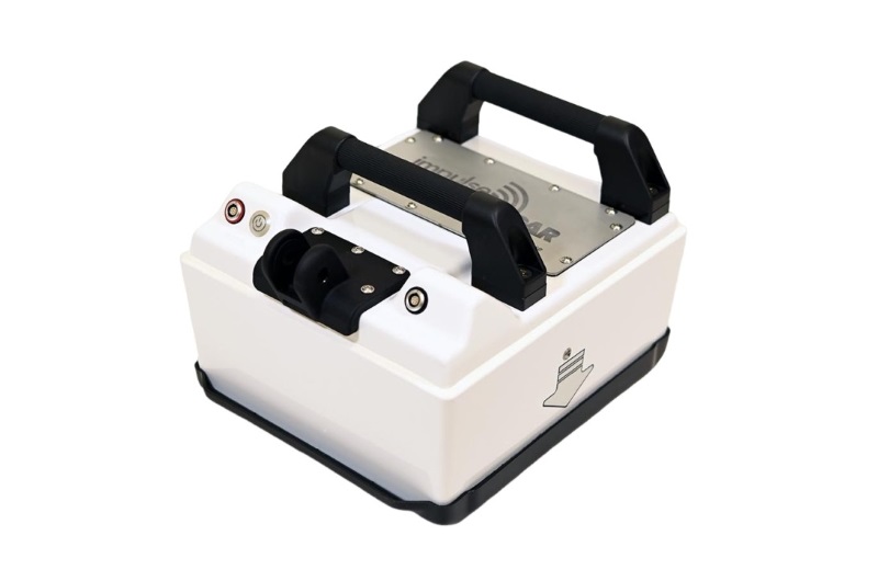
ImpulseRadar Raptor – High-Speed 3D Ground Penetrating Radar Array
The ImpulseRadar Raptor is a modular, multi-channel 3D Ground Penetrating Radar (GPR) array designed for high-speed subsurface mapping and large-area investigations. Built on ImpulseRadar's Real-Time Sampling (RTS) technology, Raptor combines multiple radar antennas into a synchronized array to collect dense subsurface data across a wide survey area.
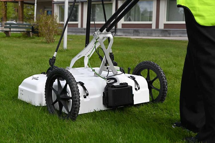
Unlike conventional single-channel GPR systems that require multiple parallel survey lines to cover an area, Raptor collects data through several channels simultaneously. This approach significantly increases survey productivity and provides closely spaced measurements for detailed 3D visualization and interpretation.
Raptor is suitable for professional applications including underground utility mapping, archaeological investigations, road and pavement surveys, railway investigations, bridge inspections, and infrastructure assessment.
Its modular architecture allows users to configure the number of antennas and channels according to project requirements, with pushcart and vehicle-mounted carrier options available.
Antennas
Raptor-45
450 MHz frequency
Raptor-45 has a center frequency of 450 MHz. Arrays configured with Raptor 45-units are suitable for utility mapping, archaeological investigations and railway investigations, among other applications.
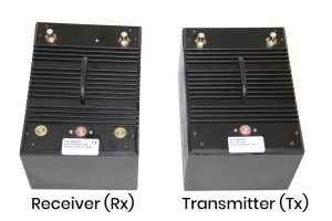
Raptor-80
800 MHz frequency
Raptor-80 has a center frequency of 800 MHz and is hence suitable for applications where higher resolutions are needed, roadbed layers, concrete scanning etc.
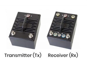
Key Features of ImpulseRadar Raptor
-
High-speed multi-channel 3D GPR data acquisition
-
Real-Time Sampling (RTS) technology
-
Modular antenna configuration from single-channel systems to large multi-channel arrays
-
Interchangeable Raptor-45, Raptor-80 and Raptor-17 antenna options
-
High-density data collection for detailed 3D subsurface imaging
-
Pushcart and vehicle-mounted survey configurations
-
Integration with external RTK-GPS and Total Station positioning systems
-
Synchronized data acquisition and positioning information
-
Talon-2 software for data acquisition and system control
-
Condor software for 3D GPR processing and interpretation
-
ViewR software for field data visualization and quality checking
Raptor Antenna Options
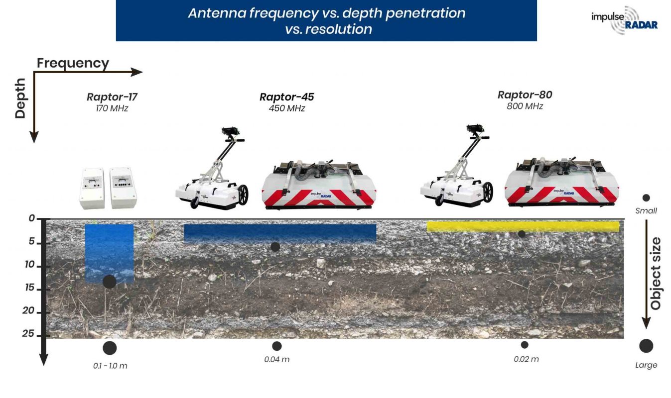
The Raptor platform supports different antenna frequencies to address different survey requirements. The choice of antenna affects the balance between penetration and spatial resolution, and should be based on the target type, survey conditions and required level of detail.
Raptor-45 – 450 MHz
Raptor-45 is designed for general-purpose 3D subsurface mapping applications. Its 450 MHz centre frequency provides a balance between penetration and resolution, making it suitable for utility mapping, archaeological investigations, railway surveys and infrastructure assessment.
It can be configured in multi-channel arrays for both pushcart and vehicle-mounted surveys.
Raptor-80 – 800 MHz
Raptor-80 operates at an 800 MHz centre frequency and is intended for applications where higher spatial resolution is required. It is suitable for investigating shallow subsurface structures, roadbed layers, pavement conditions and concrete-related applications.
The higher operating frequency generally provides more detailed information about shallow targets, although penetration is influenced by ground conditions and material properties.
Raptor-17 – 170 MHz
Raptor-17 is a lower-frequency antenna option intended for applications requiring a different penetration and resolution balance. Its larger physical dimensions mean that it does not fit the standard Raptor carrier options and requires a suitable custom carrier arrangement.
The appropriate configuration should be confirmed with the manufacturer according to the intended survey application.
Modular Multi-Channel Architecture
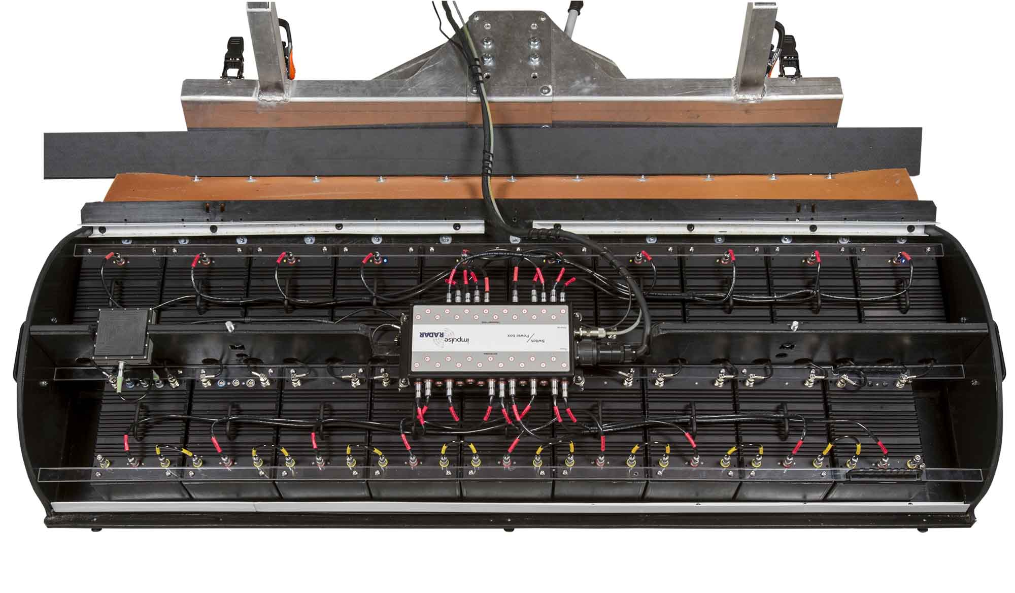
One of the main advantages of the Raptor platform is its modular design. Individual transmitter and receiver antennas can be arranged into different configurations to create a multi-channel GPR array.
The number and arrangement of channels can be selected according to the required survey width, antenna frequency, carrier type and project objectives. The manufacturer documents configurations ranging from single-channel arrangements to systems with up to 30 channels.
This flexibility allows survey teams to adapt the equipment to different projects instead of relying on a fixed antenna configuration.
A large array can also be divided into smaller configurations when required, providing additional flexibility for equipment deployment and project planning.
Pushcart and Vehicle-Mounted Configurations
ImpulseRadar Raptor supports different carrier solutions for different survey environments.
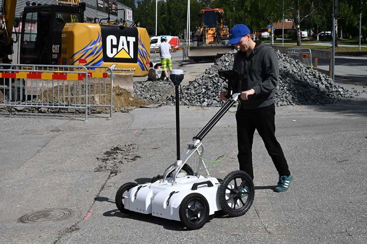
Pushcart Configuration
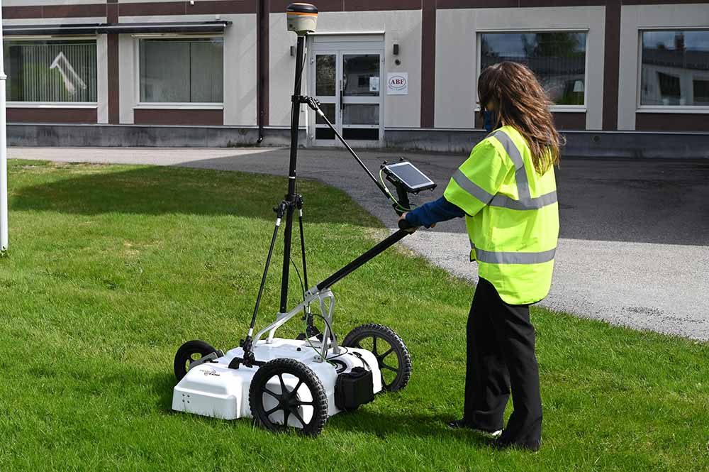
The pushcart configuration is designed for manually operated surveys in areas such as sidewalks, pavements, smaller survey sites and locations with restricted vehicle access.
The standard carrier supports up to 8 channels for Raptor-45 and up to 12 channels for Raptor-80, according to the manufacturer's technical documentation.
Its foldable design makes transportation and storage easier. The antenna mounting arrangement allows adjustment to maintain suitable ground clearance and contact conditions during data acquisition.
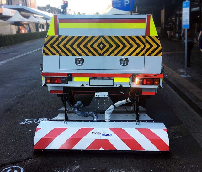
Vehicle-Mounted Configuration
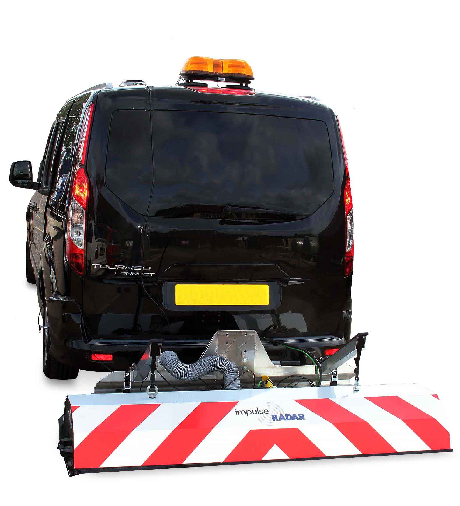
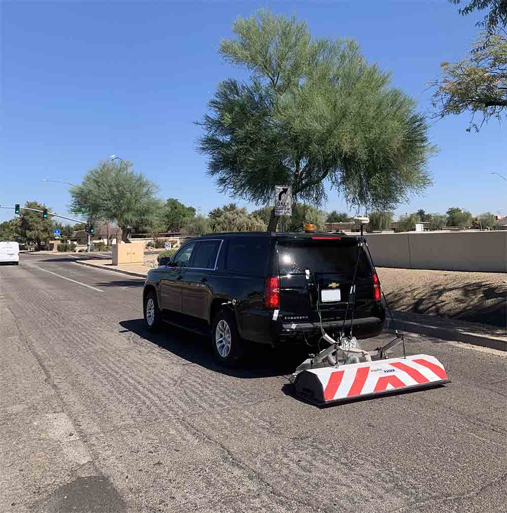
For large-area surveys and road investigations, Raptor can be installed on a suitable survey vehicle.
The vehicle-mounted system supports up to 18 Raptor-45 channels or up to 28 Raptor-80 channels in the configurations specified in the current user manual.
This arrangement enables rapid data collection over extensive survey areas. Raptor-45 configurations can achieve survey speeds exceeding 130 km/h at a 5 cm point interval, while the documented Raptor-80 configuration supports speeds exceeding 70 km/h at the same point interval.
Actual survey speed depends on the antenna configuration, positioning system, acquisition settings, road conditions and project requirements.
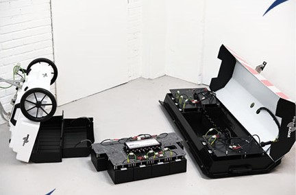
Easy set up kit
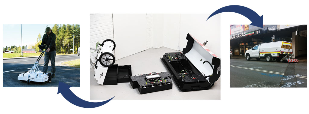
We are pleased to announce a redesign to the internal mechanics of the Raptor vehicle-mount carrier. This change increases the flexibility of the Raptor 3D GPR array solution by enabling quicker reconfiguration between the Raptor pushcart and vehicle-mount carriers. While it has always been possible to make such changes due to Raptor’s modular design, the accompanying video shows how this new arrangement makes it that much easier and faster.
Benefits
- Quickly change configurations to suit site conditions
- Serve a broader range of projects
- Save money on equipment investment
3D GPR Data Acquisition and Imaging
A conventional single-channel GPR survey typically requires multiple parallel survey lines to build a dataset covering a wider area. The quality of the resulting 3D model depends heavily on line spacing, positioning accuracy and interpolation.
Raptor uses multiple closely spaced antenna channels to collect data simultaneously. This creates a denser dataset and reduces the need for repeated passes with a single antenna.
The collected data can be processed into 3D visualizations, allowing survey professionals to examine subsurface structures from different directions and investigate the spatial relationships between detected features.
The closely spaced measurements also help reduce information loss associated with widely spaced survey lines and excessive interpolation.
Positioning and Survey Synchronization
Accurate positioning is essential for producing reliable 3D GPR datasets.
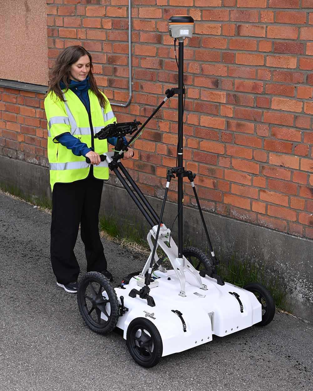
Raptor supports wheel encoder-based distance measurement and external positioning systems, including survey-grade RTK-GPS and Total Station equipment.
The system uses its internal GPS timing functionality to time-tag individual data records. External RTK-GPS or Total Station equipment is recommended for accurate spatial positioning, particularly when collecting data for 3D mapping.
The manufacturer recommends survey-grade positioning with centimetre-level accuracy for 3D data collection. In locations where reliable satellite positioning is unavailable, a Total Station can be used as an alternative.
Four-wheel Raptor push cart carrier
- Updated hood design offering extra support for more sturdy protection and longevity
- New rear axel design with larger and more rugged wheels to assist in survey alignment over rough and uneven terrains
- New magnetic axle encoder for more accurate and reliable distance measurements
- New four-wheel option, with support for the existing three-wheel version to match user requirements and survey conditions
- New higher-capacity rechargeable battery allows up to ten hours of continuous operation
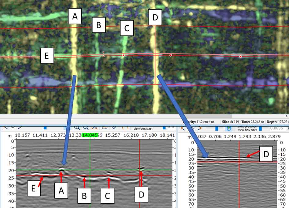
GPR Data
Collection | Interpolation | Processing | Migration | Interpretation
Software and Data Processing
The Raptor system works with dedicated ImpulseRadar software for data acquisition, quality control, visualization and interpretation.
Talon-2 – Data Acquisition and Control
Talon-2 is the Windows-based acquisition and control software used to configure and operate Raptor antenna arrays.
Its functions include:
-
Antenna configuration and system control
-
Data acquisition management
-
Positioning system integration
-
Monitoring of GPR and positioning data quality
-
Survey data storage and export
Condor – 3D Processing and Interpretation
Condor is ImpulseRadar's 3D GPR processing and interpretation software. It provides tools for managing, processing, visualizing and interpreting multi-channel Raptor datasets.
The software supports the transformation of acquired radar data into 3D subsurface representations for professional analysis.
ViewR – Field Visualization and Quality Control
ViewR is a Windows-based visualization utility that allows users to review Raptor data in an interpolated top-view format without first importing the project into Condor.
This is particularly useful for checking survey coverage and positioning data quality while still in the field.
Applications of ImpulseRadar Raptor
The Raptor multi-channel GPR platform can support a wide range of professional subsurface investigation projects.
Underground Utility Mapping
Collect dense GPR data for mapping buried utilities and investigating the location and spatial distribution of subsurface infrastructure.
Archaeological Investigations
Survey archaeological sites and investigate buried structures, foundations, remains and other subsurface features across larger areas.
Road and Pavement Surveys
Investigate road structures, pavement layers and subsurface conditions using high-density GPR data.
Railway Investigations
Support railway infrastructure surveys and subsurface investigations along railway corridors.
Bridge and Infrastructure Inspection
Collect GPR data for evaluating selected infrastructure structures and investigating subsurface or internal material features, depending on the antenna configuration and survey method.
Geological and Environmental Investigations
Use multi-channel GPR datasets to investigate shallow subsurface variations and support selected geological and environmental survey projects.
Antenna Specification Comparison
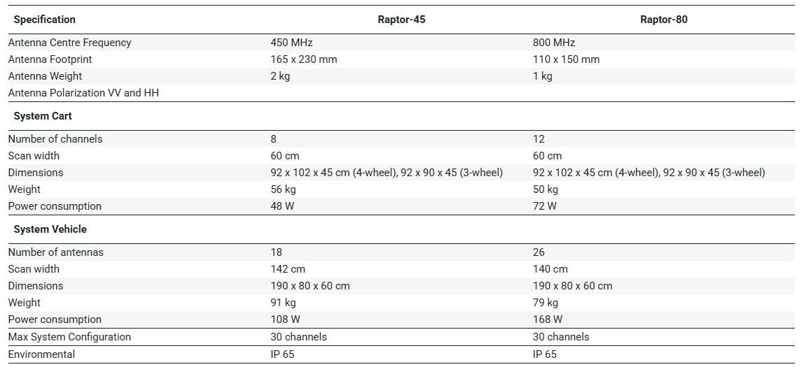
Antenna frequency vs. depth penetration vs. resolution
Technical Specifications
The following specifications are based on ImpulseRadar's published product information and user documentation. Some values depend on the antenna frequency and carrier configuration.
General System Specifications
-
Technology: ImpulseRadar Real-Time Sampling (RTS)
-
System type: Multi-channel 3D Ground Penetrating Radar Array
-
Antenna options: Raptor-45, Raptor-80 and Raptor-17
-
Maximum documented configuration: Up to 30 channels
-
Acquisition modes: Wheel, time and manual
-
Positioning: Wheel encoder, external GPS and Total Station
-
GPS protocol: NMEA 0183
-
Data time-tagging: Up to 1 ms GPS-time accuracy
-
Signal-to-noise ratio: Greater than 100 dB
-
Significant/useful number of bits: Greater than 16 bits
-
Scans per second: More than 800
-
Data acquisition rate: 160 MHz
-
Bandwidth: Greater than 120% fractional bandwidth at -10 dB
-
Power supply: 12 V rechargeable Li-ion battery or external 12 V DC source
-
Operating temperature: -20°C to +50°C
-
Environmental protection: IP65
Antenna Specifications
Raptor-45
-
Centre frequency: 450 MHz
-
Antenna footprint: 230 × 165 × 160 mm
-
Antenna weight: Approximately 1.85 kg
-
Survey speed: More than 130 km/h at 5 cm point interval
-
Time window: 166 ns in the documented 18-channel configuration
Raptor-80
-
Centre frequency: 800 MHz
-
Antenna footprint: 150 × 110 × 90 mm
-
Antenna weight: Approximately 0.87 kg
-
Survey speed: More than 70 km/h at 5 cm point interval
-
Time window: 125 ns in the documented 24-channel configuration
Raptor-17
-
Centre frequency: 170 MHz
-
Antenna footprint: 450 × 220 mm
-
Antenna weight: Approximately 4.3 kg
-
Carrier configuration: Requires a suitable custom carrier solution
Standard Carrier Configurations
Pushcart
-
Raptor-45: Up to 8 channels
-
Raptor-80: Up to 12 channels
-
Raptor-45 scan width: Approximately 60 cm
-
Raptor-80 scan width: Approximately 60 cm
Vehicle-Mounted System
-
Raptor-45: Up to 18 channels
-
Raptor-80: Up to 28 channels
-
Raptor-45 scan width: Approximately 140 cm
-
Raptor-80 scan width: Approximately 140 cm
Downloads:
ImpulseRadar Raptor GPR vehicle system
ImpulseRadar Raptor GPR push cart