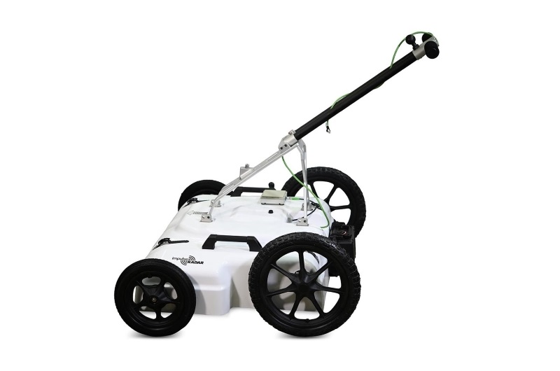
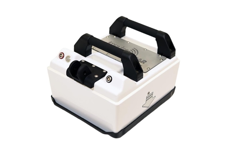
ImpulseRadar PinPointR 3D – 8-Channel 3D Ground Penetrating Radar System
The ImpulseRadar PinPointR 3D is a professional multi-channel Ground Penetrating Radar (GPR) system designed for efficient three-dimensional subsurface investigations. Combining an eight-channel antenna array with a 450 MHz centre frequency, it enables high-density GPR data acquisition for mapping underground structures, utilities, and other subsurface features.
Designed to make professional 3D GPR surveying more accessible, the PinPointR 3D features a lightweight and compact platform with a total system weight of approximately 25.4 kg. Its one-person transport and deployment design makes it suitable for survey teams that need the capabilities of an eight-channel 3D GPR system without the logistical complexity of larger survey platforms.
The system uses ImpulseRadar Real-Time Sampling (RTS) technology to deliver high-speed data acquisition, high signal quality, and detailed subsurface information. With integrated GPS support and compatibility with external DGPS and RTK-GPS equipment, survey data can be geographically referenced for mapping and reporting.
The PinPointR 3D operates with ImpulseRadar ViewPoint 2 acquisition software and integrates with Condor software for advanced GPR data processing, 3D visualization, and interpretation.
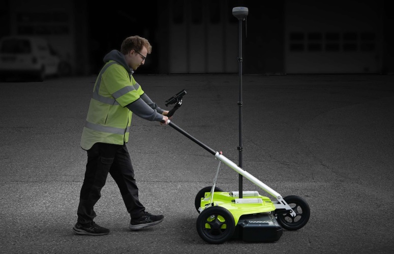
8-Channel 3D GPR Technology
The main advantage of the ImpulseRadar PinPointR 3D is its eight-channel antenna configuration.
Unlike conventional single-channel GPR systems that primarily collect individual profiles, a multi-channel array acquires data from several parallel channels during the same survey operation. This allows the system to collect a denser set of spatial measurements and build a three-dimensional representation of the surveyed area.
The PinPointR 3D has a channel coverage width of approximately 59 cm, measured from the centre of channel 1 to the centre of channel 8. This arrangement supports efficient area coverage and reduces the need to collect every survey line individually.
The collected data can be processed and visualized as 3D datasets, helping operators examine the location, distribution, and continuity of subsurface features across the surveyed area.
Real-Time Sampling (RTS) Technology
The PinPointR 3D uses ImpulseRadar Real-Time Sampling technology for high-speed GPR data acquisition.
Its specified signal-to-noise ratio exceeds 100 dB, with more than 16 significant or useful bits. The system supports an acquisition rate exceeding 800 scans per second and a data acquisition rate of 160 MHz.
These characteristics provide a high-quality data acquisition platform for professional subsurface surveys.
The antenna has a centre frequency of 450 MHz and a fractional bandwidth greater than 120% at -10 dB. This frequency configuration offers a practical balance between resolution and penetration for a range of near-surface investigation tasks.
Actual detection depth and target visibility depend on soil conductivity, moisture content, ground composition, target dimensions, antenna configuration, and survey conditions. No universal detection depth can be specified for all environments.
The easier path to
Professional 3D GPR
Professional 3D GPR delivers valuable subsurface insight. But for many surveyors, the move to 3D has meant
more equipment, greater complexity, and a steeper learning curve.

Portable
A lightweight 25.4 kg platform designed for one-person transport and deployment.

Simple
A streamlined workflow designed to make setup, acquisition, and field operation straightforward.

Professional
An 8-channel architecture delivering high-quality 3D data for confident interpretation
Applications
The ImpulseRadar PinPointR 3D is designed for professional subsurface mapping and investigation projects where three-dimensional GPR data can provide more detailed spatial information than conventional individual profiles.
Underground Utility Mapping
The eight-channel array can be used for mapping buried utilities and infrastructure, including the investigation of underground service routes and other subsurface features.
Three-dimensional data acquisition helps surveyors examine the spatial relationships between detected features and prepare more comprehensive utility maps.
Road and Transportation Infrastructure
The PinPointR 3D can support GPR surveys of roads and transportation infrastructure, where systematic area coverage and spatially referenced subsurface information are important.
Potential survey objectives include investigating subsurface structures and identifying variations beneath road surfaces.
Infrastructure Investigation
The system can be used for non-destructive subsurface investigations around infrastructure projects, helping surveyors examine buried structures and underground features without immediate excavation.
Large-Area Subsurface Surveys
The multi-channel configuration is suitable for surveys requiring efficient coverage of larger areas. Its portable design makes it practical for field teams working across different survey locations.
Construction and Engineering Surveys
Three-dimensional GPR data can support preliminary subsurface investigations for construction and engineering projects, including the assessment of underground conditions before excavation or other ground-disturbing activities.
The suitability of the system for a specific target or material should be evaluated according to the project's survey requirements and ground conditions.
ViewPoint 2 – Field Data Acquisition Software
The PinPointR 3D uses ImpulseRadar ViewPoint 2 as its data acquisition platform.
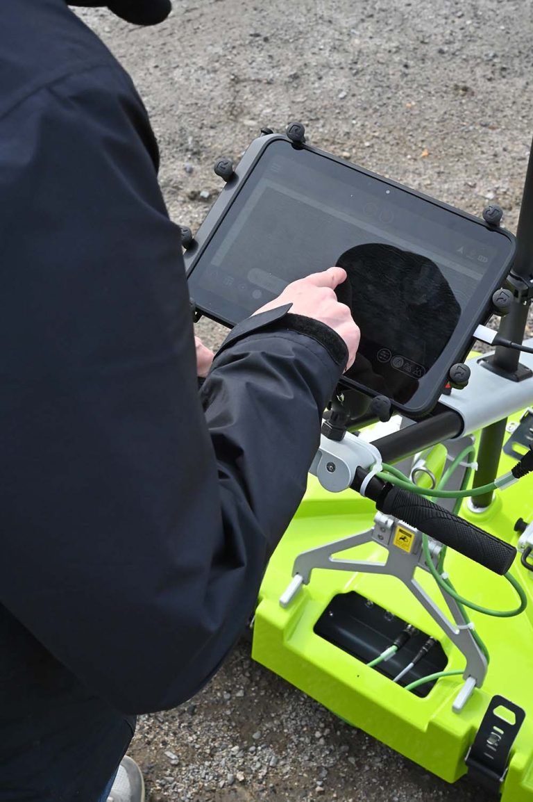
ViewPoint 2 is designed to simplify the field workflow by bringing survey configuration, data acquisition, and in-field visualization together in a tablet-driven interface.
The software helps operators manage the essential stages of a GPR survey without requiring a complicated field setup.
Its main role is to support:
-
Survey setup and configuration.
-
GPR data acquisition.
-
In-field data visualization.
-
Monitoring the survey workflow.
-
Reviewing collected data during field operations.
The tablet-based interface is designed to make professional 3D GPR surveying easier to learn and operate.
Condor – 3D GPR Data Processing and Interpretation
After data acquisition, PinPointR 3D datasets can be processed and interpreted using ImpulseRadar Condor software.
Condor provides advanced processing and visualization tools for working with three-dimensional GPR data. It helps transform the collected measurements into more useful subsurface representations for analysis and reporting.
The combination of ViewPoint 2 and Condor creates a complete workflow from field data acquisition to advanced processing and interpretation.
ViewPoint 2 is primarily used for data collection and field visualization, while Condor is used for more advanced data processing and interpretation.
Positioning and Georeferencing
Accurate positioning is important for GPR projects that require reliable mapping and reporting.
The PinPointR 3D includes integrated GPS support and can also work with external GPS equipment. For projects requiring higher positioning accuracy, compatible DGPS and RTK-GPS configurations can be used.
The system also supports wheel encoder and Total Station positioning options.
GPS data is supported through the NMEA 0183 protocol, and data time-tagging is specified to within 1 ms of GPS time.
These positioning options allow survey teams to select an appropriate georeferencing method according to the accuracy requirements of the project.
Portability and Field Operation
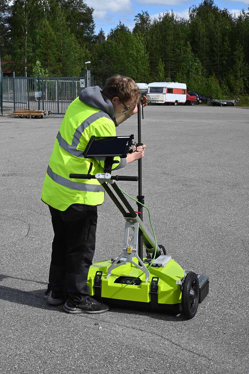
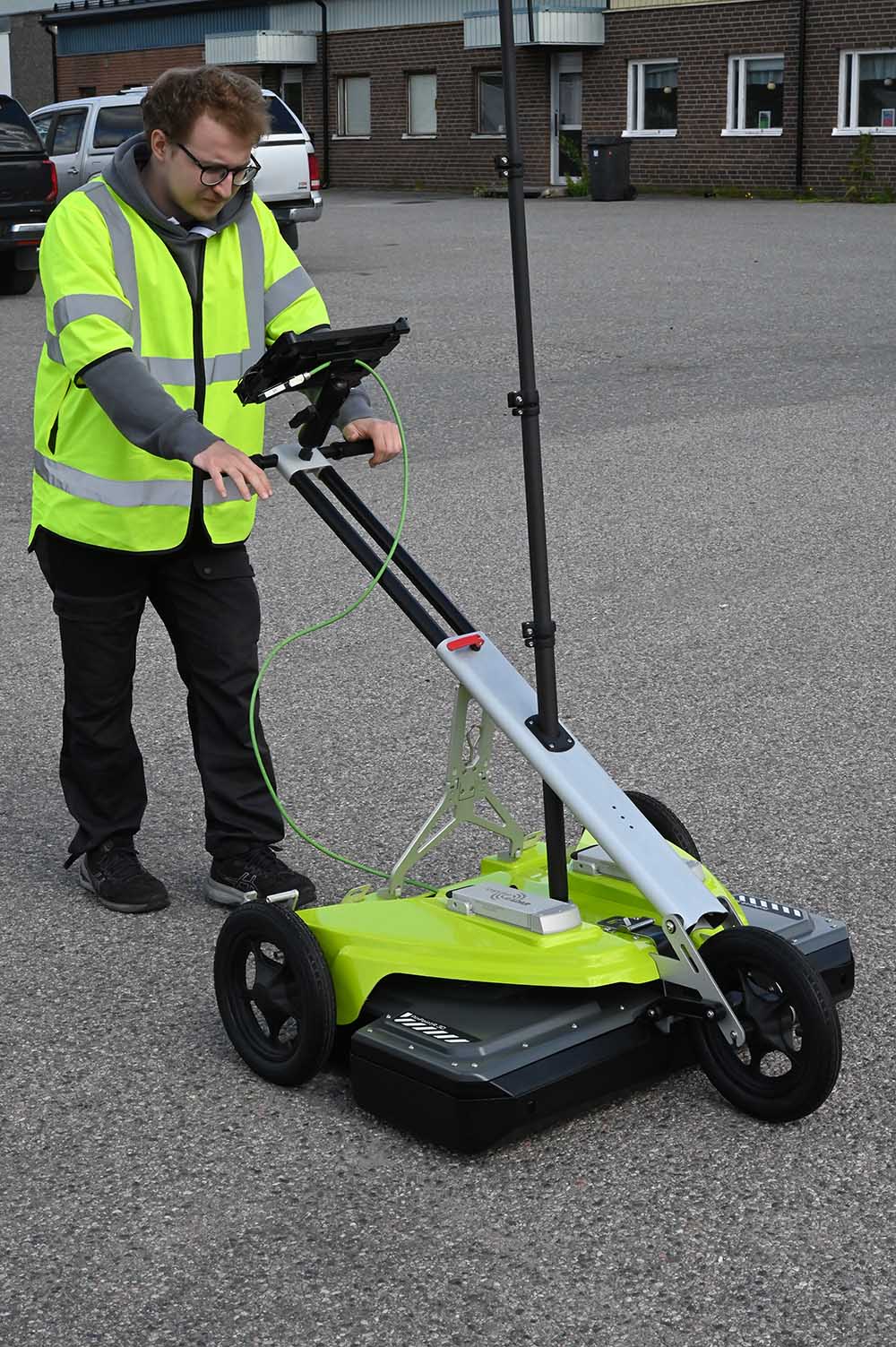
One of the defining characteristics of the PinPointR 3D is its compact and lightweight design.
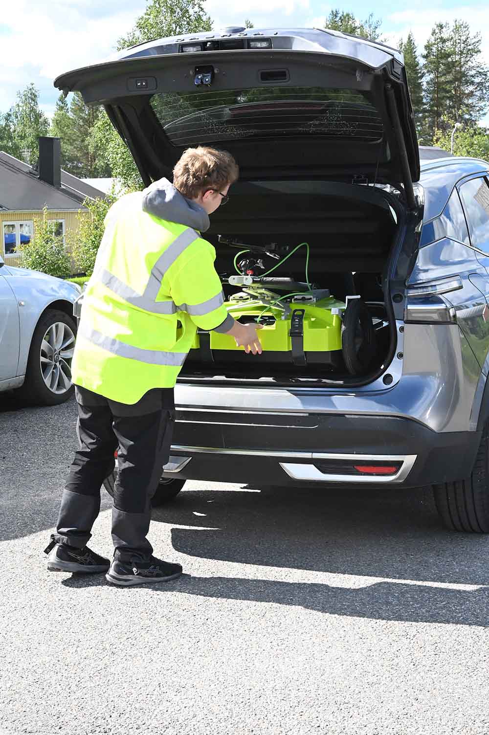
With a combined weight of approximately 25.4 kg for the antenna and cart, the system is designed for transportation and deployment by a single operator.
Its compact platform helps simplify vehicle transport, equipment handling, and field preparation. The system is intended to reduce the logistical requirements often associated with larger multi-channel GPR arrays.
The antenna has an IP65 environmental protection rating and is specified for operation between -20°C and +50°C, supporting use in a range of outdoor survey environments.
Easy Transportation
Fast Deployment
Efficient Field Operation
Reliable 3D Results
Technical Specifications
| Specification | Details |
|---|---|
| Manufacturer | ImpulseRadar |
| Model | PinPointR 3D |
| GPR Technology | Real-Time Sampling (RTS) |
| Antenna Configuration | 8-channel 3D array |
| Centre Frequency | 450 MHz |
| Signal-to-Noise Ratio (SNR) | Greater than 100 dB |
| Significant / Useful Bits | Greater than 16 bits |
| Scans per Second | Greater than 800 |
| Data Acquisition Rate | 160 MHz |
| Time Window | 166 ns (8-channel configuration) |
| Bandwidth | Greater than 120% (-10 dB fractional) |
| Survey Speed | Greater than 130 km/h at 5 cm point interval (specified acquisition capability) |
| Acquisition Modes | Wheel, Time, Manual |
| Swath Coverage Width | Approximately 59 cm |
| Positioning | Wheel encoder, external GPS, Total Station |
| GPS Support | Integrated GPS and external GPS |
| GPS Protocol | NMEA 0183 |
| Data Time-Tagging | To 1 ms of GPS time |
| Operating Time | Approximately 5.4 hours with the specified 2 × 8.7 Ah battery configuration |
| Battery Configuration | Hot-swappable battery system |
| Antenna Dimensions | 880 × 600 × 190 mm |
| Antenna Weight | 13.2 kg |
| Cart Weight | 12.2 kg |
| Total System Weight | Approximately 25.4 kg |
| Operating Temperature | -20°C to +50°C |
| Environmental Protection | IP65 |
| User Interface | Android tablet-based |
| Display Resolution | 720 × 1280 pixels or better |
| Operating System | Android 10 or later |
| Acquisition Software | ViewPoint 2 |
| Post-Processing Software | Condor |
| Regulatory Certification | CE, FCC, IC |