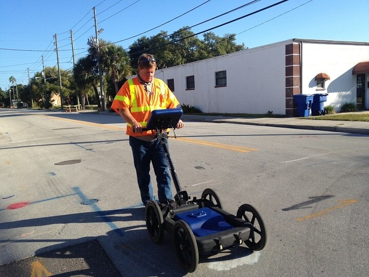
Q25 Geophysical Radar System
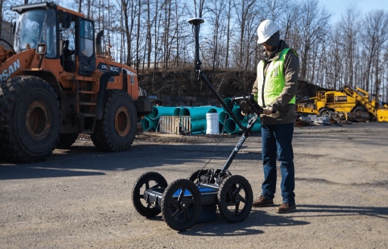
The Q25 geophysical GPR system is a 250 MHz locating system for deep utilities and geophysical applications. The Q25 has the greatest penetration depth for a wide variety of uses including the locating and mapping subsurface objects. With a rugged, durable design and easy-to-learn interface, there is no other ground penetrating radar system on the market that is this easy to master and operate.
Is the Q25 GPR system the right solution for your next project? Contact us to learn about the Q25’s range of applications and we would be happy to advise you on the best option for your specific needs.

Featured Technologies
Q25 Hardware Technologies:
- SmartGain 2
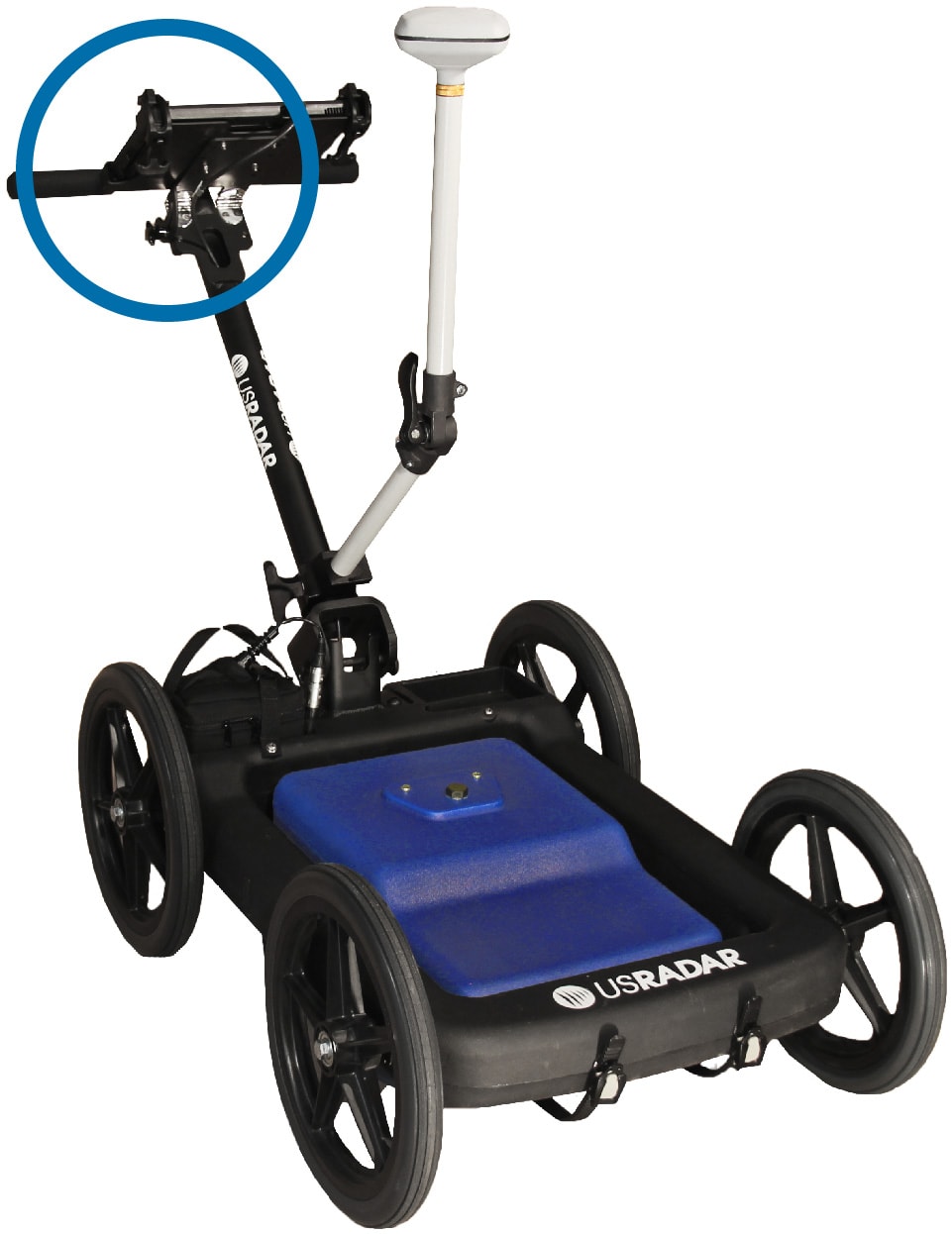
- Folding Rough Terrain Cart
- Self-Calibrating Antenna
Q25 Software Technologies:
- SmartStack
- StreetSmart Real-Time Processing
- Autoconfiguration
- Depth Calibration
Features
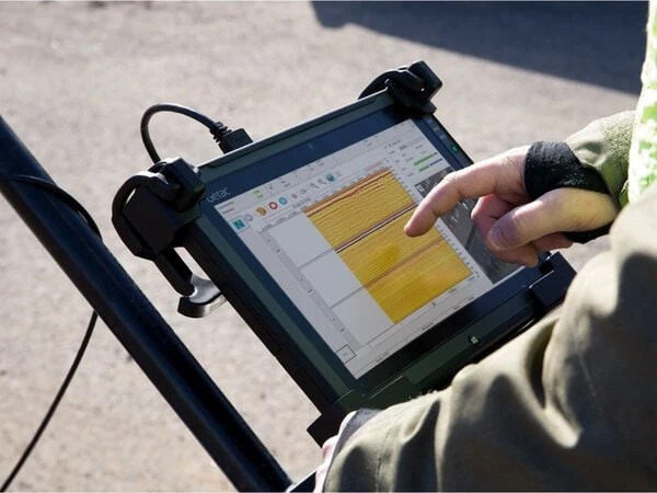
Durable, Glare-Resistant Tablet Interface
- Daylight readable, weatherproof Getac tablet interface
- High performance CPU enables real-time data processing
- Built-in 3D view capability
- WiFi supported
- USB, Ethernet, HDMI and Audio ports
Easy Storage
- Folding cart handle and easy mount for easy storage
Long Life Battery Packs
- Each battery lasts a total runtime of 8 hours each
- Battery packs have lifespan of several years
Airless, Solid Tires
- Airless, solid tires that cannot go flat
- Require no maintenance
Sloped Antenna Design
- Easily glides over obstacles
- Optional GPS integration
- Military-grade connectors for secure connection between antenna and controller
Optional GPS Integration
- Optional GPS Pole mount
- Enables GPS to be centered over antenna
- Integrates with most high-end GIS and RTK units
- Optional integration with Google Earth
Software
Acquisition Software
- Easy to use out of the box
- Perfect for on-the-go locating
- Auto-Calibrates Antenna
Autoconfiguration
- Sets system parameters
- Adjusts to soil conditions

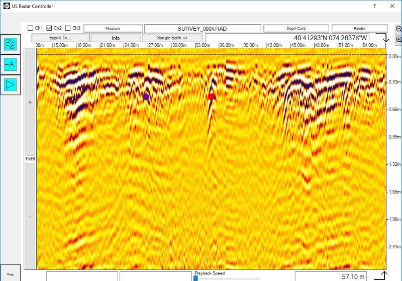
Time-Varying Gain & Manual Configuration
- Enhance image at desired depth
- Multiple gain configuration filters
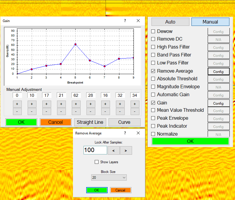
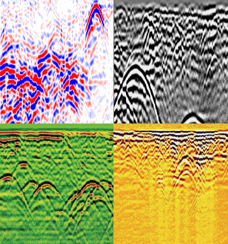
Color Palettes
- Use pre-made or make your own
- Alter gain (contrast)
- Zoom to enhance view
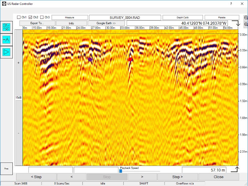
Mark-out & Measure Data
- Mark & label points in radar data
- Measure distance between points

Automatic Report Generation & File Export
- Exports radar data automatically
- Choose from many file formats

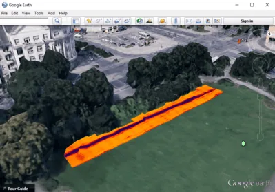
Optional Google Earth/SatelliteImaging Software Integration
- Overlay radar data on satellite imaging
- Create reliable utility maps
- See data in relevant environmental context
- Annotate & map data

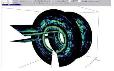
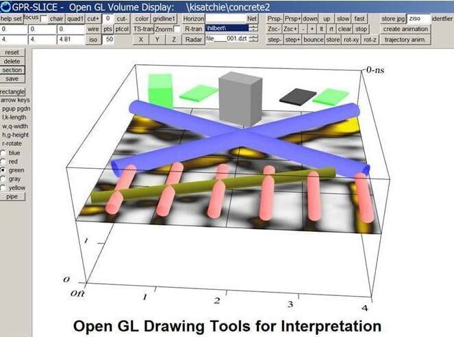
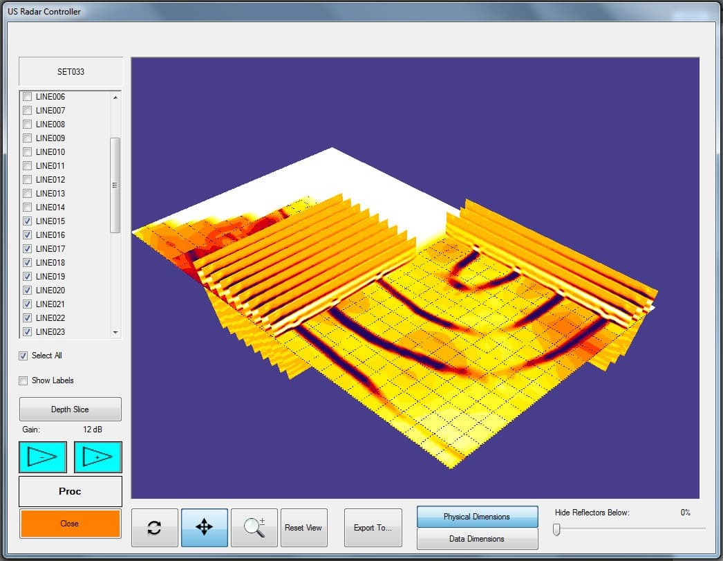
Optional 3D Imaging & Modeling
- Generate depth slices overlays
- Generate point clouds
- Create isosurface models
Optional Mapping Software
- Create as-built drawings
- Use in the field or at the office
- Export into many file formats

Optional 3rd Party Software Integration
- US Radar data can also be processed in several third party software packages.
- Contact us or your US Radar representative for more info.

Applications
- Deep Utility Detection & Locating
- Geophysics
- Tunnels
Specifications
Radar Controller Computer
Getac F110
- Operating System: Windows 7 or 10 64-bit
- Third-generation Intel® Core™ i5vPro™ Processor
- Durability: MIL-STD-810G, 4-foot drop and all-weather IP65 dust and water resistant design
- Display: 11.6 inch, HD daylight-readable, ten-point multi touch + digitizer
- I/O Interface: Ethernet Port, DC Power Port, 1 USB 3.0 Port, HDMI Port, WiFi and Bluetooth
- Expansion Options: MicroSD or second USB 2.0 port, RJ45 Ethernet, Dedicated GPS
- Communications: Wi-Fi, Bluetooth® and optional 4G LTE or 3G Gobi™
Software
- Microsoft Windows
- US Radar Control Software Including:
- System Configuration
- A Scan Display (Oscilloscope Mode)
- B Scan Display (Cross Sectional View)
- C Scan Display (3D) (Optional)
- Real Time Signal Processing
- Data Storage and Playback
System Scan Modes
- Maximum typical logging scan rate of 390 traces per second
- Trigger Modes: Free run, timed interval, shaft encoder, GPS, manual
- Nominal Sampling Rate: 650,000,000 samples per second
- Maximum Resolution: 100 Gigasamples per second
- Hardware Time Varying Gain: 45dB
- Software Time Varying Gain: 60dB
- Software Flat Gain: 60dB
System Environmental Specifications
- Temperature: -11 deg. To 50 deg. C
- Moisture and dust resistance: IP 65
Radar Hardware Specifications
- Sampling Interval: 10 ps-6.4 ns
- Time Range Adjustment Interval: 10 ps
- Pulse Repetition Frequency: 0.1-4 MHz-adjustable
- Samples per Trace: 2-8192, Adjustable
- Effective Bandwidth (typ.): >4 GHz
- Stacking: Automatic
- Transmitter: Broadband, available as 250 or 270 MHz Center Frequency
- Receiver: Direct RF Sampling
Support
- Warranty: 2 Years Parts and Labor
- Complimentary telephone and email technical support