Geoscanners SPG-1700B
The Geoscanners SPG-1700B is a compact, all-in-one Ground Penetrating Radar (GPR) system designed for high-resolution shallow subsurface investigations. The system integrates the transmitting and receiving antennas, control electronics, power supply, and onboard data storage into a lightweight unit weighing less than 1 kg. While the SPG-1700B is a complete GPR solution for conventional ground surveys, its compact size and extremely low weight also make it suitable for airborne applications when mounted on compatible UAVs or aerial platforms. The system delivers high-quality radar data, autonomous operation, and flexible communication through Wi-Fi or Ethernet.
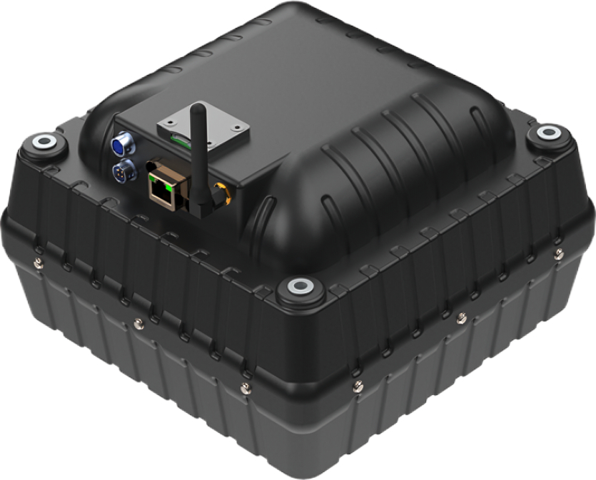
The first and only complete Ground Penetrating Radar system with bi-static antennas and onboard storage below 1kg.
The SPG-1700 is an all in one Ground Penetrating Radar unit. This unit comprises the transducer, both transmitting and receiving ones, as well as the control electronics and power supplies needed for the operation of the unit.
The control application runs on Windows operating system and can establish communications with the unit via the Ethernet port of the computer or via WiFi where the SPG-1700 functions as an access point.
The SPG-1700 has also the possibility to record the data to a local micro SD card for autonomous roving operation.
The SPG-1700 counts with one port for connecting an external GPS receiver to be able to attach coordinates data to each and every collected radar trace.
The extremely low power consumption of the unit allows for long time operation without interruption.
Features
- Ice road measurement
- shallow surveys
- On board media storage
- Ethernet and WiFi
Advantages
- Ultra-lightweight construction for maximum portability
- High-resolution imaging for shallow underground investigations
- Fully integrated hardware with no external control unit required
- Autonomous data recording through onboard microSD storage
- Low power consumption for extended field operation
- Flexible deployment on carts, vehicles, robotic platforms, or UAVs
- GPS compatibility for accurate positioning and mapping
- Reliable operation in demanding surveying environments
Technical specifications
- Dimensions - 220x220x130mm
- Weight - 991g
- Frequency - 1200MHz
- HS code - 90158020