Terra Exploration Group MGM4000
Magnetic Gradient Mapper
Professional Magnetic Field Mapping and Subsurface Detection
The MGM4000 is a professional-grade Earth's Magnetic Field survey instrument engineered to reveal underground what traditional tools miss. Using Low-SWaP dual tri-axial magneto-inductive sensors and precision gradient measurement, it maps changes in the Earth's Magnetic Field to reveal buried structures, voids, metals, pipelines, water, and mineral targets with exceptional clarity up to 20 Meters — all in real time.
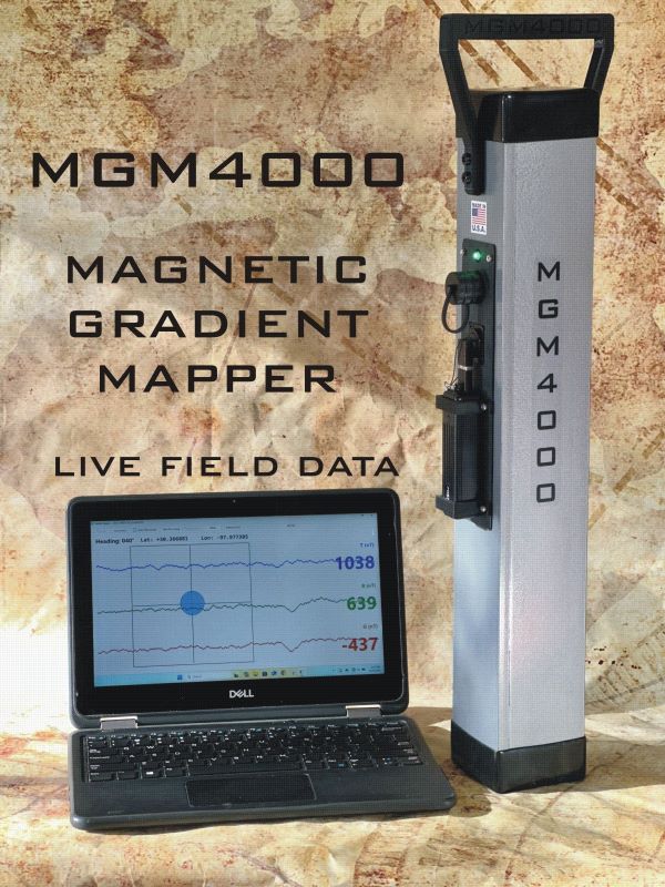
The MGM4000 is a portable, ground-based magnetic gradiometer designed for high-resolution mapping of subsurface magnetic gradients associated with geological structure, lithological contrast, and mineralization-related alteration.
The system employs paired low-SWaP magneto-inductive vector magnetic sensors operating in a fixed-baseline configuration to measure first-order magnetic field gradients, enabling discrimination of localized geological features while suppressing regional magnetic background.
The collected data can be displayed during the survey, allowing the operator to observe magnetic anomalies and their spatial distribution in real time.
This approach makes the MGM4000 particularly useful when the objective is not simply to locate a single target, but to map an underground anomaly and understand its shape, extent and position.
Real-Time Magnetic Mapping
One of the key features of the MGM4000 is its ability to provide live magnetic gradient data and instant field imaging during a survey.
The system can display magnetic measurements as the operator moves across the survey area. This allows potential anomalies to be identified while fieldwork is still in progress rather than waiting until the entire survey has been completed.
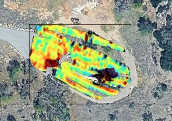
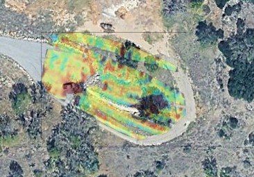
The Terra Exploration Group system also supports post-processing functions through the Terra X Mapper App, including interactive data visualization, data editing, 3D graphing, GPS and gradient data display, KMZ export and satellite-image overlays.
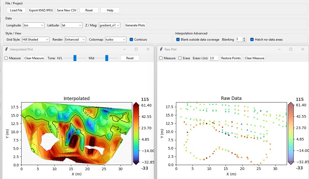
Post Image Processing with the Terra X Mapper App
High-Sensitivity Magnetic Gradient Measurement
The MGM4000 is designed to detect relatively small variations in the Earth's magnetic field. Terra Exploration Group specifies sub-nanotesla sensitivity and a 0.5-meter gradient baseline for the system.
Advanced onboard filtering and tilt compensation are incorporated to help maintain data quality when surveying over uneven terrain or during operator movement.
These characteristics are particularly important in magnetic surveying because small variations in sensor orientation, movement and environmental interference can influence the measured magnetic field.
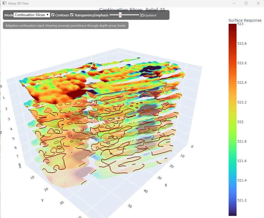
3D Interactive Data Graphs
What Can the MGM4000 Detect?
Magnetic surveying cannot directly identify every type of underground target. Its effectiveness depends on the magnetic properties of the target and surrounding ground.
However, magnetic anomalies can be associated with a wide range of underground features, including:
- Buried ferrous objects
- Buried metallic structures
- Underground pipelines
- Archaeological structures
- Geological formations
- Mineralized zones
- Iron-rich geological formations
- Underground cavities and void-related anomalies
- Other subsurface magnetic anomalies
Terra Exploration Group states that the MGM4000 can be used to investigate buried structures, voids, metals, pipelines, water and mineral targets, with an advertised detection depth of up to 20 meters depending on target and ground conditions.
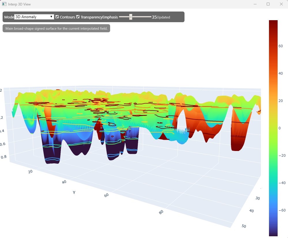
3D Interactive Data Graphs
Applications of the MGM4000
- Archaeological Surveys
- Geological and Mineral Exploration
- Underground Void and Cavern Investigation
- Pipeline and Utility Surveys
- Buried Object Detection
Magnetic Mapping
One of the main advantages of the MGM4000 is its emphasis on mapping.
A point-based detection system may indicate that a target is present at a particular location. A magnetic mapping system can provide a broader picture of how magnetic values change across an area.
This makes the MGM4000 useful for applications where understanding the shape, continuity and spatial distribution of an anomaly is important.
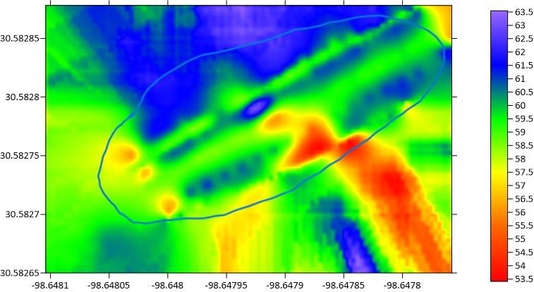
The resulting data can be examined as profiles, 2D magnetic maps and 3D visualizations, providing additional information for interpretation.
GPS and Geospatial Data
The MGM4000 integrates magnetic gradient measurements with positioning information, allowing survey data to be associated with geographic coordinates.
The Terra X Mapper App provides GPS and gradient data visualization and supports KMZ export and satellite imagery overlays. This allows survey results to be viewed in a geographic context and compared with satellite imagery or other mapping information.
Terra X Mapper App
The MGM4000 is supported by the Terra X Mapper software environment, which provides tools for viewing and processing magnetic survey data.
Features presented by Terra Exploration Group include:
- Real-time gradient data visualization
- GPS position display
- Interactive measurement tools
- Unwanted-data removal
- 2D magnetic mapping
- 3D interactive data graphs
- Post-processing capabilities
- KMZ export
- Satellite image overlay
- Adjustable satellite-image transparency
These tools allow users to review field measurements and perform additional analysis after completing a survey.
MGM4000 Specifications
Product: MGM4000 Magnetic Gradient Mapper
Manufacturer: Terra Exploration Group
Technology: Magnetic Field Measurement / Magnetic Gradiometry
Sensors: Dual tri-axial magneto-inductive magnetic sensors
Sensor Baseline: 0.5 m
Sensitivity: Sub-nanotesla
Data Visualization: Real-time magnetic gradient mapping
Positioning: GPS
Data Processing: Terra X Mapper App
Export: KMZ
Mapping: 2D magnetic maps and 3D data visualization
Tilt Compensation: Yes
Onboard Filtering: Yes
Advertised Detection Depth: Up to 20 m, depending on target and ground conditions
Warranty: 2 years
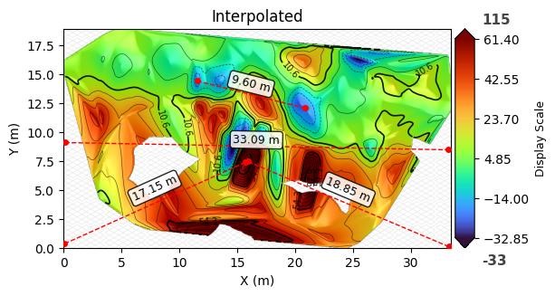
Interactive Measurement Tool
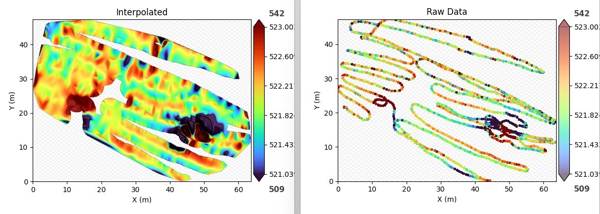
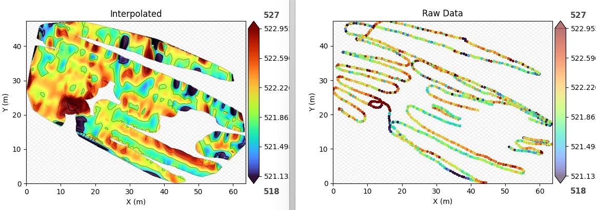
Interactive Unwanted Data Eraser:
Before
After
KMZ Export & Satellite Image Overlay with Adjustable Transparency