Geoscanners BA-500
Borehole Antenna
BA-500 is a GPR borehole antenna with mid frequency operating bandwidth for applications requiring access to the features via a nearby borehole. Clean signal and higher penetration, packaged into a smaller and more compact casing, surpass the similar solutions from any of our competitors. BA-500 is an ideal complement for companies surveying marble quarries, salt mines or any other application requiring borehole antennas with a good balance between the penetration and resolution.
Borehole antennas are used to extend the amount of information one can get from a drilled borehole. By collecting GPR data with a borehole antenna one can observe and interpret the obtained data showing the media around the borehole at a certain depth.
The dimensions of the antenna where made industry friendly, meaning that after you get the standard drilling tool out you can easily push the antenna in the hole. GPR information gathered in this way will reduce the overall number of holes needed for the final report, providing much more information than just drilling.
Areas of Application
- Mining industry surveys
- Quarry surveys
- Tunnel digging prediction surveying
- Tunnel safety surveys
- River bottom profiling
Surveys with borehole antennas are some of the harder GPR survey types to conduct and interpret. One of the main reasons for the difficulty is that borehole antennas are unshielded and non-directive antennas. The resulting data from a single borehole is in fact gathered from the 360 degree plane around the borehole rather than a specific direction. This allows for an object to be determined by the distance the antenna is lowered to and the radius showing the distance of the object from the borehole with no regard to the azimuth. This can also create interesting and slightly misleading reflection patterns from two or more objects at the same radius and different azimuth from the borehole, merging as one in the data.
One way of circumventing the mentioned problem is to collect data from the same area from different boreholes using the same antenna. This will allow to triangulate the true position of the object in the post processing phase. Another suggestion is to use two antennas; one as a transmitter and the other one as a receiver. The antennas must be used in different boreholes, creating a true tomography image of the area.
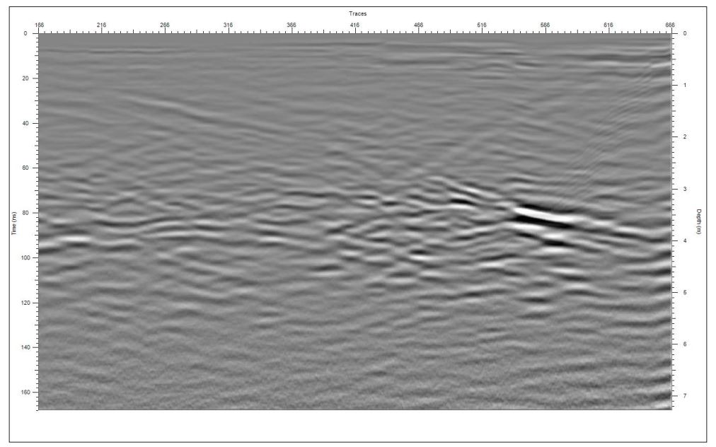
Borehole data collected with the BA-500 antenna.

Air to water transition during the antenna calibration.
Features
Technical specifications


